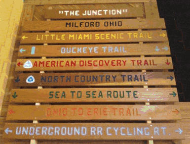
Creating Trail Connections for all Ohioans . . .
The 1,444 mile Buckeye Trail winds through 49 of Ohio's 88 counties, Ohio's only National Forest, our largest National Park, 18 State Parks, 5 State Forests, 4 Wildlife Areas, 8 Ohio Historical Society properties, 6 Watershed Conservancy lands, 18 County or Metropark lands, and is hosted by many private landowners as well. The length and breadth of Ohio's State Trail creates a backbone for Ohio's growing trail system. Ohio's Buckeye Trail is hosted by other trails, and is an integral portion of local trails networks within public lands near you.
BURTON SECTION
BURTON SECTION DESCRIPTION & MAP
Headlands Dunes State Nature Preserve
Greenway Corridor, Lake Metroparks
Girdled Road Reservation, Lake Metroparks
Big Creek Park, Geauga Metroparks
Maple Highlands Trail, Geauga Park District
Headwaters Park, Geauga Park District
Headwaters Trail, Portage Park District
MOGADORE SECTION
MOGADORE SECTION DESCRIPTION & MAP
Headwaters Trail, Portage Park District
MASSILLON SECTION
MASSILLON SECTION DESCRIPTION & MAP
Tuscarawas County Park Department
North Country National Scenic Trail
BOWERSTON SECTION
BOWERSTON SECTION DESCRIPTION & MAP
North Country National Scenic Trail
Conotton Creek Trail, Harrison County
BELLE VALLEY SECTION
BELLE VALLEY SECTION DESCRIPTION & MAP
North Country National Scenic Trail
STOCKPORT SECTION
STOCKPORT SECTION DESCRIPTION & MAP
North Country National Scenic Trail
American Electric Power (AEP) - ReCreation Land
NEW STRAITSVILLE SECTION
NEW STRAITSVILLE SECTION DESCRIPTION & MAP
North Country National Scenic Trail
OLD MAN’S CAVE SECTION
OLD MAN’S CAVE SECTION DESCRIPTION & MAP
North Country National Scenic Trail
SCIOTO TRAIL SECTION
SCIOTO TRAIL SECTION DESCRIPTION & MAP
North Country National Scenic Trail
SINKING SPRING SECTION
SINKING SPRING SECTION DESCRIPTION & MAP
North Country National Scenic Trail
SHAWNEE SECTION
SHAWNEE SECTION DESCRIPTION & MAP
North Country National Scenic Trail
Davis Memorial State Nature Preserve
WEST UNION SECTION
WEST UNION SECTION DESCRIPTION & MAP
North Country National Scenic Trail
Edge of Appalachia Preserve - Cincinnati Museum Center
WILLIAMSBURG SECTION
WILLIAMSBURG SECTION DESCRIPTION & MAP
North Country National Scenic Trail
LOVELAND SECTION
LOVELAND SECTION DESCRIPTION & MAP
Underground Railroad Cycling Route
North Country National Scenic Trail
CAESAR CREEK SECTION
CAESAR CREEK SECTION DESCRIPTION & MAP

TROY SECTION
TROY SECTION DESCRIPTION & MAP
City of Piqua, Ohio Bicycle Route
Five Rivers Metroparks, State Bicycle Route
North Country National Scenic Trail
Great Miami River Recreational Trail
ST. MARYS SECTION
ST. MARYS SECTION DESCRIPTION & MAP
North Country National Scenic Trail
DELPHOS SECTION
DELPHOS SECTION DESCRIPTION & MAP
North Country National Scenic Trail
DEFIANCE SECTION
DEFIANCE SECTION DESCRIPTION & MAP
Providence, Metro Parks, Toledo Area
Bendview, Metro Parks, Toledo Area
Farnsworth, Metro Parks, Toledo Area
PEMBERVILLE SECTION
PEMBERVILLE SECTION DESCRIPTION & MAP
NORWALK SECTION
NORWALK SECTION DESCRIPTION & MAP
Back Roads & Beaches, Lorain County
MEDINA SECTION
MEDINA SECTION DESCRIPTION & MAP
Hinckley Reservation, Cleveland Metroparks
Brecksville Reservation, Cleveland Metroparks
BEDFORD SECTION
BEDFORD SECTION DESCRIPTION & MAP
Brecksville Reservation, Cleveland Metroparks
Bedford Reservation, Cleveland Metroparks
South Chagrin Reservation, Cleveland Metroparks
Pedestrian bridge and path - Village of Gates Mills
North Chagrin Reservation, Cleveland Metroparks
Chapin Forest Reservation, Lake Metroparks
Penitentiary Glen Reservation, Lake Metroparks
Mentor Lagoons Nature Preserve
Mentor Marsh State Nature Preserve
Headlands Dunes State Nature Preserve
AKRON SECTION
AKRON SECTION DESCRIPTION & MAP
Brecksville Reservation, Cleveland Metroparks
O'Neil Woods, Metro Parks, Serving Summit County
ROAD FORK SECTION
ROAD FORK SECTION DESCRIPTION & MAP
North Country National Scenic Trail
WHIPPLE SECTION


